Satellite Imagery
Visible Sectors
National,
AZ,
MT,
CO,
TX,
KS,
SD,
WI,
MO,
MS,
FL,
NC,
Gulf,
NY,
Special
HOU, MCI, TUP, BMG, MCO, SAV, ROA
Infrared Sectors
National,
AZ,
MT,
CO,
TX,
KS,
SD,
WI,
MO,
MS,
FL,
NC,
Gulf,
NY,
Special,
Bloomington
Water Vapor Sectors
National,
AZ,
MT,
CO,
TX,
KS,
SD,
WI,
MO,
MS,
FL,
NC,
Gulf,
NY,
Special,
Bloomington
Regional Radar, Filtered
Large Sectors
AZ,
MT,
SD,
KS,
TX,
WI,
MO,
MS,
FL,
NC,
NY
Regional Sectors
DEN,
OKC,
MCI,
Bloomington,
TUP,
ROA,
SYR
County Lines
OMA,
HOU,
MKE,
CBM,
CLT,
Bloomington
White Background
STL,
Bloomington
Regional Radar, Unfiltered
(Legacy data source & server, no guarantees)
National
Large MS Valley
Colorado,
ND/SD,
OK/KS,
LA,
Great Lakes,
Indiana (small),
AL/MS/TN
Current Hour RAP Fields
Updated hourly by :01, hopefully
Isentropic Surfaces (temporarily disabled)
NAM Data
Point output for selected cities
4th Floor Hallway Display
This is severe.im. To learn more about how these images are produced, the about page should be helpful.
Latest major changes:
* 8 Nov 25: for reference, crude maps of regional sectors
available for:
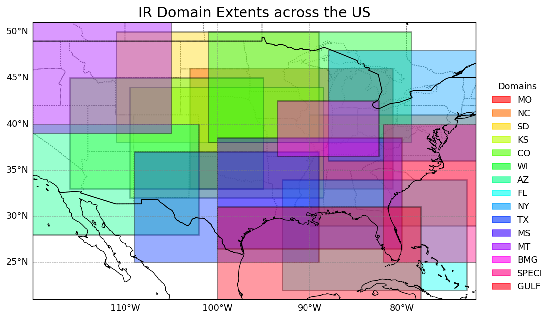
IR satellite;
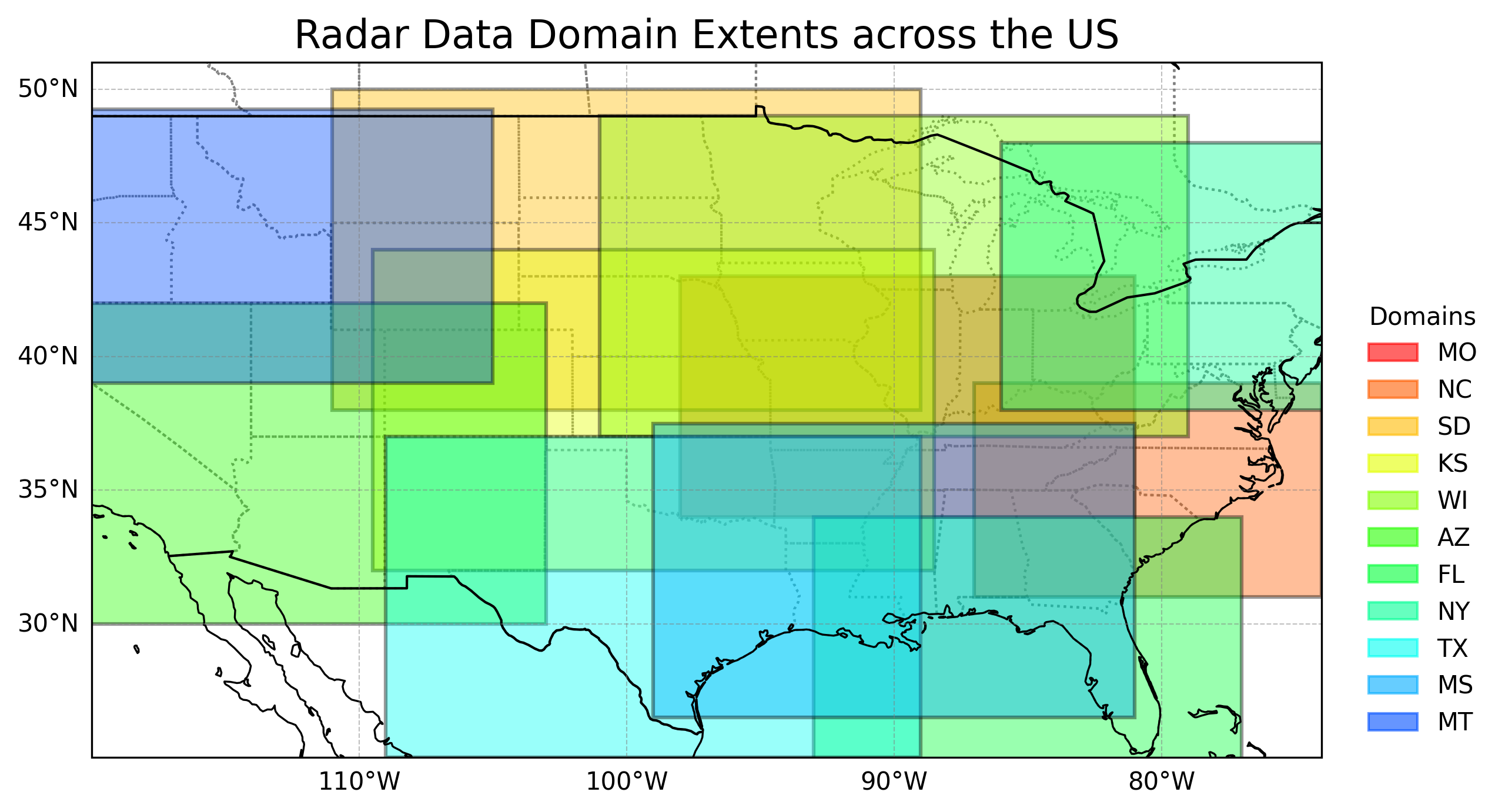
MRMS large;
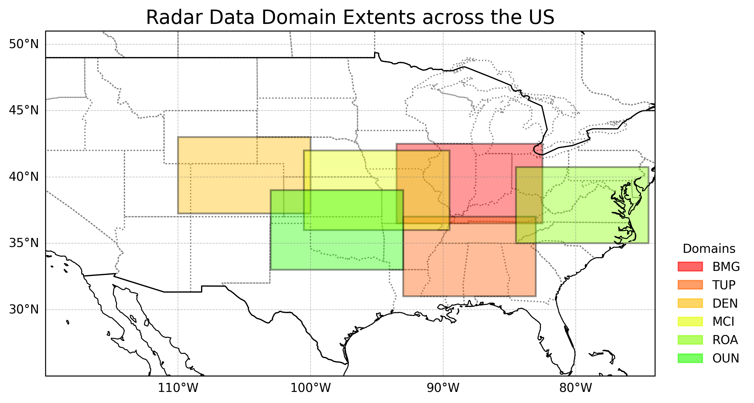
MRMS zoomed; and
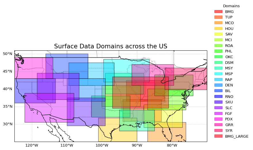
surface maps.
* 22 Sep 25:
An upstream change in the file format had broken the surface
maps for the last 3-4 days. Should be fixed now.
![]()